Beaches in The Mumbles, Glamorgan
The beach guide has 13 beaches listed in and around the town of The Mumbles. We have arranged these beaches in order of closest to the town first (distance in brackets).
-
Norton Road Beach (0.4 miles)

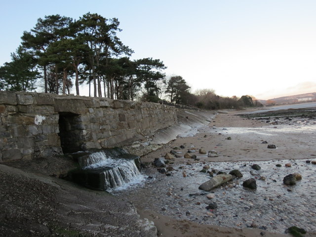
This is one of the various beaches which can be found around the sand and mud flats of Swansea Bay. The beach at Norton Road is a mix of sand, shingle and mud, backed by sea defences. There are some car parking spaces along the A4067 (Mumbles Road) to the south of the beach, and…
-
West Cross Beach (0.8 miles)
West Cross Beach is found at the western end of Swansea Bay. The beach here is sandy and at low tide, the whole of the bay becomes a wide expanse of sand and mudflats. A mixed cycle/pedestrian path runs alongside the beach all around the bay. Places to eat and shops can be found in…
-
-
Rotherslade Bay (0.6 miles)
Rotherslade Bay beach is nestled just around the corner from Mumbles and right next to the larger, better known Langland beach. The diminutive cove that forms Rotherslade is backed by cliffs with rocky outcrops to either side forming something of a natural ampitheatre. Towards high tides this gives the beach a cosy feeling, whilst at…
-
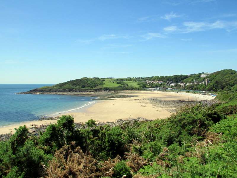
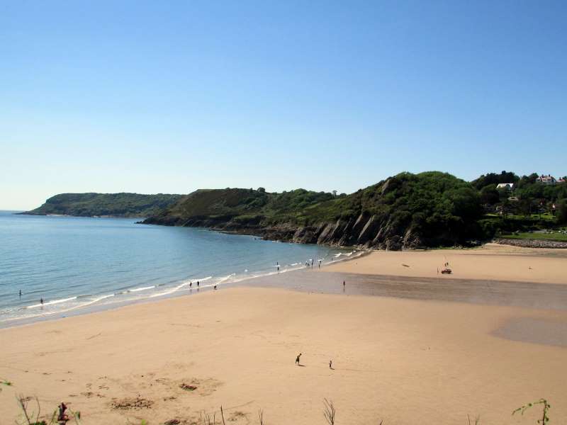
Langland Bay (0.7 miles)
Looking for a safe and pleasant family-friendly beach, sheltered from prevailing onshore winds? It’s a popular choice for water sports enthusiasts, particularly surfers, who know the sea here for its varied breaks.
Langland Bay is relatively rocky in places and sandy in others. There are plenty of rock pools to explore, as well as a…
Knab Rock Beach (0.7 miles)
At the southern end of Swansea Bay, Knabs Rock lies adjacent to the delightfully-named village of Mumbles. The sand and shingle beach here is backed by an extensive sea wall, alongside a car park and marina.
The car park here is popular with sea anglers who cast their lines over the railings above the sea wall. …
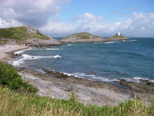
Limeslade Bay (1 miles)
Limeslade is a sheltered pebble and sand cove surrounded by cliffs. It is located just west of Bracelet Bay and is a pleasant little walk along the coast from Langland. The beach is accessed by steps and there is a car park close by at Bracelet Bay. Facilities are quite good including a small cafe…
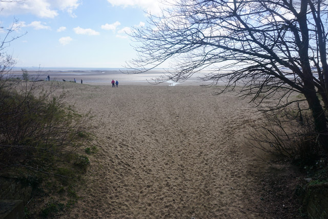
Black Pill Rock Beach (1.5 miles)
Black Pill Rock Beach forms part of the vast expanse of sand and mudflats that make up Swansea Bay. The River Clyne enters the sea along this stretch of the bay, which is approximately midway between Mumbles Pier and Swansea Marina. A grassy area lies immediately behind the beach, and young children will enjoy splashing…
Bracelet Bay (1.2 miles)
With views out to Mumbles Lighthouse, Bracelet Bay is mainly made up of rock and pebbles, forming numerous rock pools, although there are some areas of sand at low tide. Possibly taking its name from the amalgamation of ‘broad slade,' Bracelet Bay has a lifeguard presence between May and September. Even so, swimmers should stay…
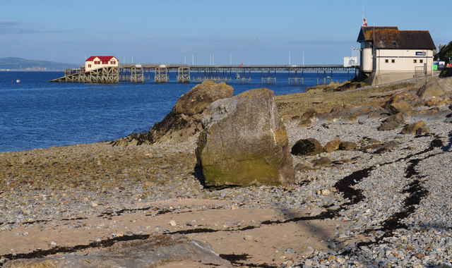
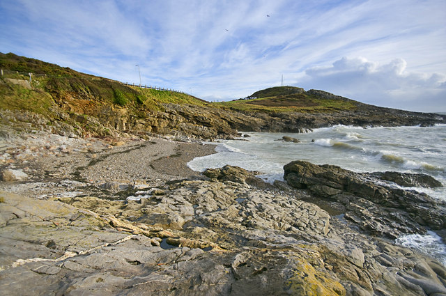
Mumbles Head Beach (1.2 miles)
Mumbles Head is a rocky headland on the south-western side of Swansea Bay. The small beach here is a mix of sand and rocks and has a reputation for being one of the best beaches in the area for rockpools, which can be teeming with crabs and tiny fish at low tide. A cycle track,…
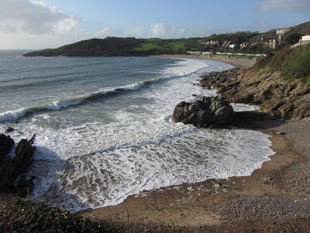
Caswell Bay (1.5 miles)
Sometimes signposted as Bae Cas-wellt in Welsh, Caswell Bay is a Blue Flag beach located on the south-eastern side of the Gower Peninsula close to The Mumbles. Offering a wide expanse of dark golden coloured sand, which reduces significantly in size at high tide, it is occasionally interrupted by natural rock formations. Behind…
Sketty Lane Beach (2.2 miles)
This is one of the many beaches found around Swansea Bay. The shoreline is sandy, with a vast expanse of sand and mudflats exposed in the bay at low tide. Sketty Lane beach is backed by a path suitable for pedestrians and cyclists, which goes around the bay in both directions. The closest car park…
Brandy Cove (1.9 miles)
This secluded little cove on the Gower Peninsula is tucked away just to the west of Caswell Bay. Access is either by walking around the steep path from Caswell or along the valley from the village of Bishopston.
At higher tides Brandy Cove is mostly rocks and pebbles, however, as the tide drops away a…
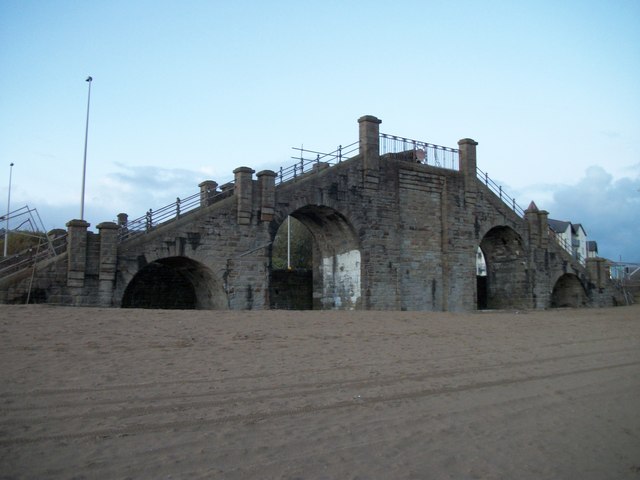
Slip Beach (3.1 miles)
This urban beach, one of several to be found around Swansea Bay, gets its name from the fact that a steel bridge used to take city dwellers across the railway line to the seafront. Today the bridge has been dismantled and part of it can be seen on the cycle path that runs alongside the…
The Mumbles beaches map
Map featuring The Mumbles beaches. Click on pins to view beach details