Beaches in Dundee, Tayside
The beach guide has 16 beaches listed in and around the town of Dundee. We have arranged these beaches in order of closest to the town first (distance in brackets).
-
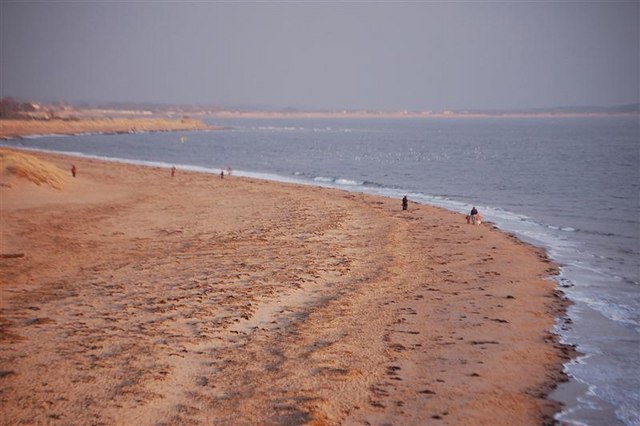
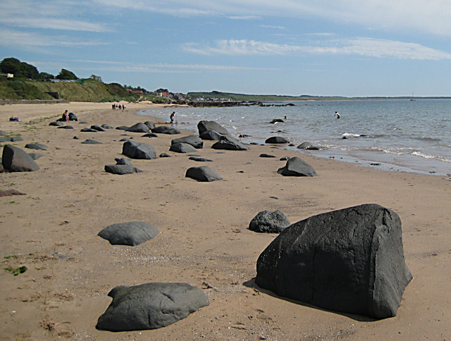
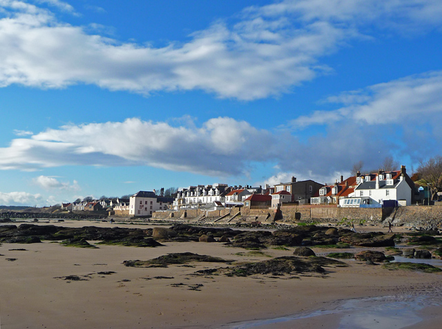
Broughty Ferry Beach (6.6 miles)

A large sandy beach, backed by dunes and overlooked by a historic castle, in Broughty Ferry, a former fishing village that's now a residential suburb of Dundee. Easy access from a promenade, a nature conservation site and great views across the Tay estuary to the North Fife coast.
-
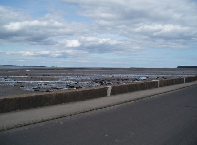
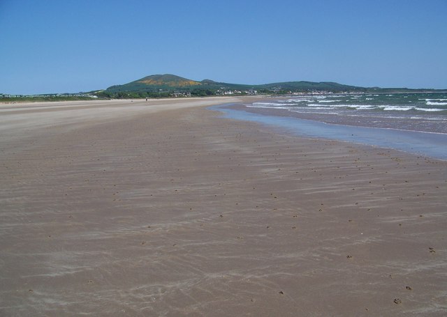
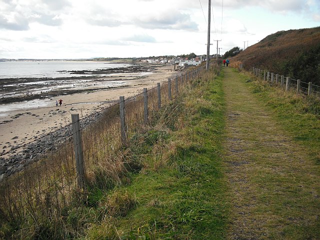
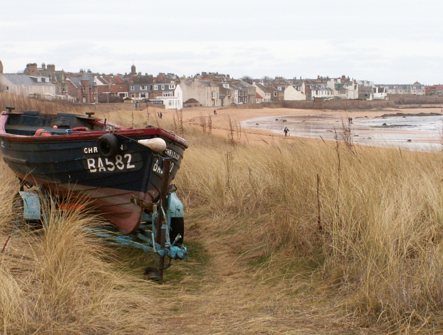
Tayport Beach (6.4 miles)
Tayport Beach is a stretch of sand and shingle to the south east of Tayport Harbour. From the beach there are views out onto the mouth of the Firth of Tay. At low tide, there is a vast expanse of sand, but the tide rushes in and the entire area can be submerged at high…
-
-
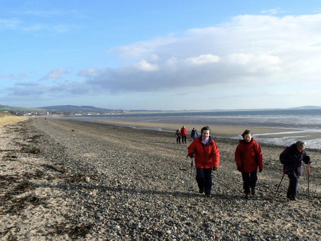
Monifieth Beach (8.4 miles)
Monifieth is a long, sandy beach looking out over the Firth of Tay, with views across towards the southern side. The beach has a number of sea defences, with wooden groynes becoming exposed at low tide. A number of rocks are also exposed, providing an opportunity to explore the pools around them them for signs…
-
Tentsmuir Sands Beach (9.9 miles)
Close to the mouth of the Tay Estuary, Tentsmuir Sands is a wide expanse of clean sands backed by grassy dunes, and Tentsmuir Forest. The remains of various wartime defences can be found both on the beach and in the forest. These were built by Polish troops who were stationed here during the Second World…
-
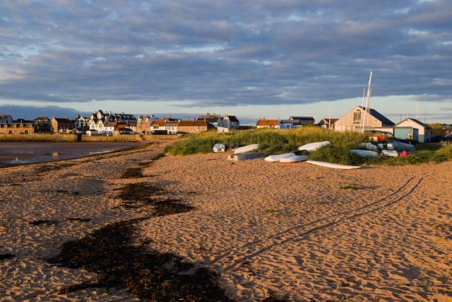
West Beach (19.8 miles)
Leven is a resort town overlooking the Firth of Forth. It has plenty of amenities, and there are two golf courses and some good walks to be enjoyed in the area.
West Beach forms the townward part of a long stretch of sand north-east from the mouth of the River Leven to Lundin Links. The beach…
-
Leven East Beach (19.3 miles)
The popular seaside resort of Leven lies on the north side of the Firth of Forth, at the mouth of the river bearing the same name. The town offers plenty of amenities and places to stay.
Many visitors come here for the long, sandy beaches and for the good walking to be had in the area. …
-
-
Lundin Links Beach (19 miles)
Lundin Links is an attractive, quiet, sandy beach offering excellent views out onto the Firth of Forth. Whilst it is mostly sandy, it becomes rockier opposite the village of Lundin Links and towards Lower Largo. There is some roadside parking alongside Links Road; about 100 meters back from the beach, which can be reached along…
-
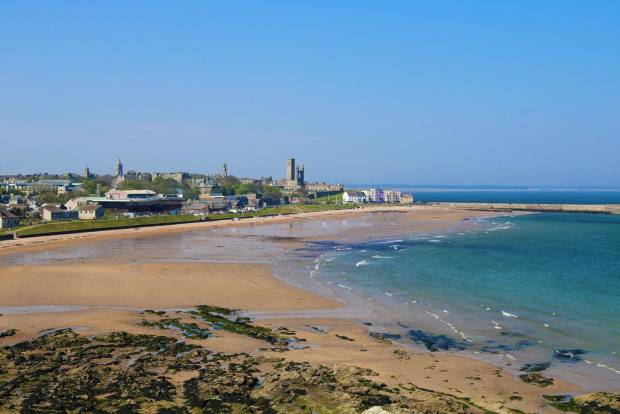
St Andrews West Sands Beach (12.6 miles)
West Sands is the largest and best-known beach in St Andrew's, surprisingly one of the sunniest and driest places in Britain.
The south end of the two-mile-long sandy beach featured in the opening sequence of Oscar-winning film, Chariots of Fire, while the north end is popular with kite surfers and overlooks the Eden Estuary Nature Reserve,…
-
Lower Largo Beach (19 miles)
Lower Largo Beach is located in the pretty village of Lower Largo on the coast of Fife. The village and beach sit to the north of the Firth of Forth and this is an attractive spot with a long and interesting maritime history.
The beach is made up of a good-sized stretch of soft sand and…
-
Largo East Beach (19.1 miles)
Largo East is a sandy beach, just to the east of the ancient fishing village of Lower Largo. On 1676 this was the birthplace of Alexander Selkirk, whose sojourn on a desert island, following a shipwreck provided the inspiration for Daniel Defoe's novel Robinson Crusoe. A signpost in the village directs visitors to the Juan…
-
St Andrews East Sands Beach (13.9 miles)
Located on the south side of the old harbour, St. Andrews East Sands is a popular beach destination for both locals and visitors to Fife. The sandy beach has a path on the inland side, making it an ideal location for walkers. It is also within close proximity to the harbour and sailing club, so…
-
Shell Bay (20.9 miles)
Shell Bay is a mostly sandy beach with some pebbles closer to the water's edge. It lies in a secluded area of the Fife coastline, looking south onto the Firth of Forth. Behind the beach there is a caravan park with children's play area, shop, café and toilets. The beach is popular for swimming as…
-
Earlsferry Beach (21.7 miles)
Elie Earlsferry Beach joins the villages of Elie and Earlsferry in Fife and sits next to Elie Harbour Beach.
The beach is known for its family friendly sands and is a centre for water sports. In the summer months cricket is a popular pastime at the beach and the western side of the beach has…
-
Elie Harbour Beach (21.9 miles)
Tucked away in the lee of Elie's harbour is this lovely stretch of golden sand. Although quite modest at high tide when the tide goes out the beach joins up with neighbouring Earlsferry to form almost a mile of sand.
Being located in a sheltered bay, by the harbour, Elie Harbour beach is a great…
-
Elie Woodhaven (Ruby Bay) (22.1 miles)
A quiet and sheltered sandy beach with easy access to a range of facilities.
Backed by dunes, with views over the Firth of Forth. Great walking in the surrounding countryside.
-
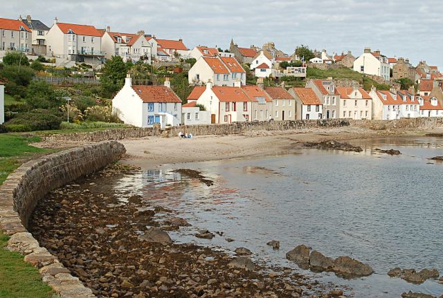
Pittenweem Beach (21.9 miles)
Pittenweem is a picturesque fishing village, with the most active fishing harbour on the whole of the East Neuk Coast. It offers excellent views to the south over the Firth of Forth. The harbour is in the centre of the village along East Shore. A short walk west along Mid Shore and West Shore, will…