Beaches in Wick, Highland
The beach guide has 5 beaches listed in and around the town of Wick. We have arranged these beaches in order of closest to the town first (distance in brackets).
-
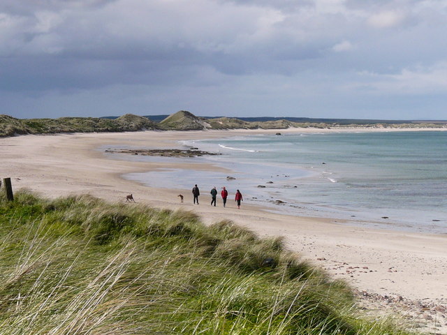
Sinclairs Bay - Reiss Beach (3.5 miles)

On a sunny day, the beach at the southern end of Sinclairs Bay, known locally as Reiss Beach, is spectacularly beautiful. The long stretch of pure, white sands alongside the azure waters of the North Sea will take your breath away. Take a walk along the endless beach, or amongst the gentle sand-dunes. Come here…
-
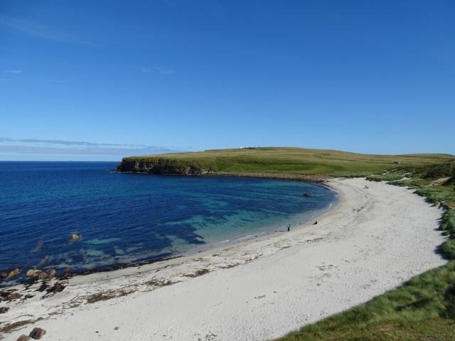
Sinclairs Bay - Keiss (6.5 miles)
About 12 miles south of John O’Groats, just off the A99 is the coastal village of Keiss, with its small, historic harbour and not much else, apart from this stunning, rather desolate beach. Keiss Beach, found at the northern end of Sinclair Bay is wild and full of windswept beauty. At this end of Sinclair…
-
-
Bay of Sannick (14.4 miles)
Sitting between John O'Groats and Duncansby Head Lighthouse, Sannick beach is very nearly the most northerly in mainland Britain. It is somewhat ironic that this remote spot has become more well known because of its remoteness. It is about half a mile from the iconic signpost at John O'Groats so well worth a stroll if you are…
-
Dunnet Bay (15.3 miles)
Dunnet Bay is located at the northern end of the wide, sandy beach between Castletown and Dunnet, close to the north-eastern tip of Scotland. The pale expanse of sand stretches for over 2 miles and is backed by dunes and the grassy plains found along the north of Scotland, known locally as "machair". The closest…
-
Castlehill Beach (15 miles)
Castlehill Beach lies close to the eastern tip of Scotland's northern coastline, between Castletown and Dunnet. The beach forms the western end of Dunnet Bay, a long stretch of sand and shingle, backed by grassy dunes. Behind the dunes, the A836 runs adjacent to the beach. The beach is used by surfers and is a…